Since its inception in 1789, Parramatta has evolved with a rich legacy of historic and public assets.
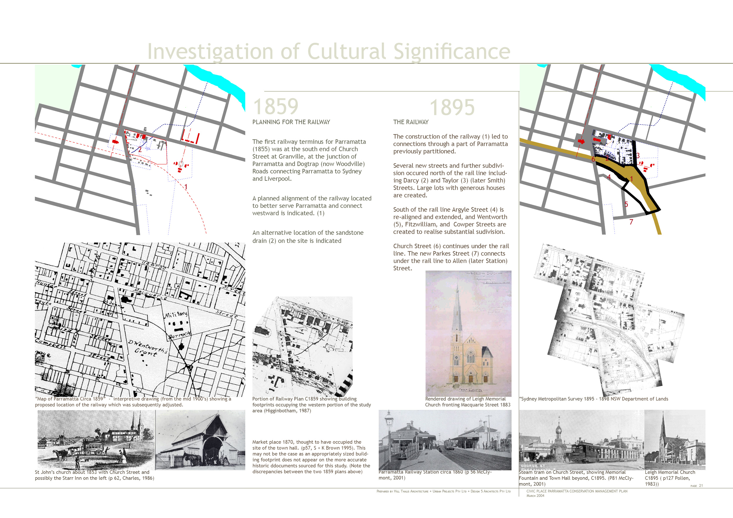
Parramatta’s 1789 plan was laid out by Governor Phillip and later enriched with cross axes and significant public buildings by Governors Hunter and Macquarie. The decisive alignments of George and Church Streets retain the sense of the initial layout. One of the characteristics of the city plan is the large size of the urban blocks. Brownrigg’s 1844 plan indicates the Civic Place site occupying the western edge of an aberrant extra large block, even compared to Parramatta’s other blocks. The block was further complicated by the 1860 railway alignment and the block’s geometry remains awkwardly resolved today.
Parramatta’s Civic Place site has long been recognised for its considerable Aboriginal historical significance, both before and after 1788. It is now one of several consolidated Council owned lots occupying the centre of Parramatta, providing important pedestrian connections through the blocks between the railway line and the river.
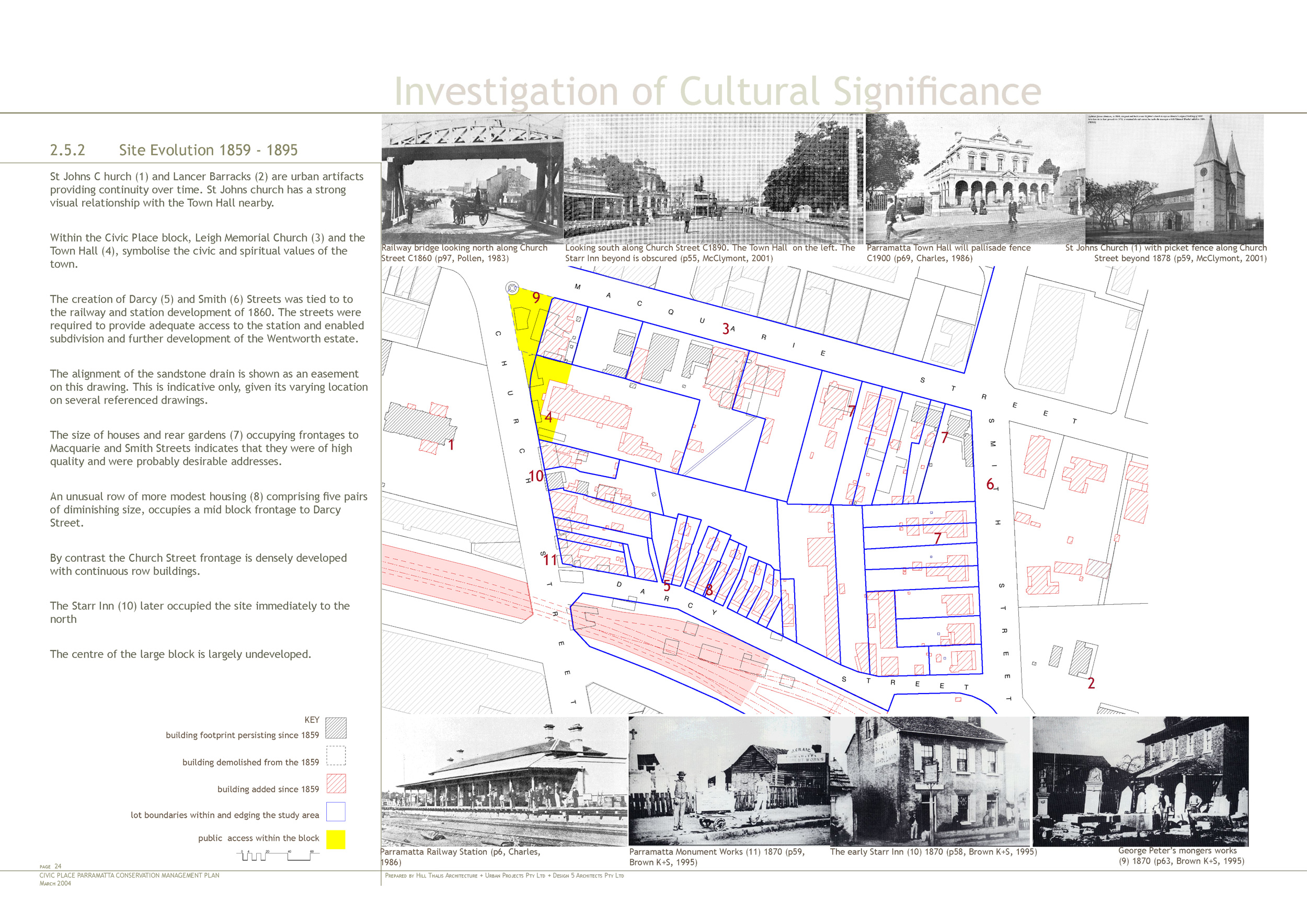
There are significant urban elements in the Civic Place block including the 1890’s and 1950’s Town Halls, St John’s Church, Leigh Memorial Church and a convict built subterranean drain.
There are also significant buildings and areas bordering the site which contribute to the block’s importance. These include St John’s Anglican Church and surrounds, Centennial Square and Church Street, Arthur Phillip High School, Lancer Barracks and the Railway Station.
Taken together the site’s ensemble of public and private buildings, subdivision lines and spaces forms an important civic quarter for Parramatta and includes the evolving history of buildings serving local government and promoting civic life in the city to date.
A significant part of the process of developing the Conservation Management Plan has been the close collaboration between Design 5 – Architects and Hill Thalis Architecture + Urban Projects, to bring urban design and urban heritage into the heritage evaluation of place. The resultant document aims to be as graphic, informative and accessible as possible, to make it more likely to be used. It includes the extensive use of drawings for the investigation, assessment and policy sections